In the outer reaches of Western Sydney, I accidentally do some journalism. Sort of.
Agnes Banks
No, Agnes Banks isn't your great aunt, or the nice old lady from up the road who used to speak to you while you walked to school. It turns out that Agnes Banks is a suburb in Sydney's Outer West, chilling vaguely between the centres of Penrith and Richmond.
Due to its relative distance from the rest of the city, getting here is a little bit of a Sydney by Technicality affair, along tree-laden semi-rural roads. Regardless, I've chosen not to label the suburb as one by technicality seeing as this place sits in Penrith Council, which is a very real part of Sydney (as much as folks in the east may deny it).


That Sydney border is often defined by the Nepean River. Naturally, that's where I headed next.
But I wasn't expecting to see this.


The recent storms and flooding really took a toll on this usually quite pretty place, with overturned trees, dirt everywhere and the river running a very deep brown.

I crossed the bridge to the other side of the Nepean (arguably leaving Sydney, despite remaining in the borders of Agnes Banks),


Even from just the car park, the damage is very real,


the carpark also overlooks the Nepean, so here's another angle of the raging river and its napping trees.

To get to the main bit of the reserve, I crossed the road from one car park,
to get to another, less formal one. As a piece of trivia, that tipped over sign in the background more or less marks Agnes Bank's western border.


I saw this sign advertising a lookout, so I figured I'd give it a try.

The path to the lookout was not really a path any more,

and the lookout was also not really a lookout either.

Regardless, I continued on towards a promised swimming area.

To reach here. This is the picnic area which was clearly breached by the floodwaters. 


This is next to the swimming spot where some people were still keen to go in for a dip. One kid emerged looking like he had just spent some time at The Dead Sea.

I didn't go all the way to the swimming area as I wasn't keen on ruining my sneakers, but I did find a spot where I could take a picture of the still nice water.

I'm sure the place will be cleaned up soon (if it hasn't already). To see what it was like before the high tides, this "Parra Parents" blog post does a pretty great job of it. http://www.parraparents.com.au/things-to-do/water-fun/yarramundi-reserve-richmond/
Managing to get out of there relatively clean, I headed back to the car park and went on to my next suburb.

Agnes Banks: My muddiest suburb, by far.


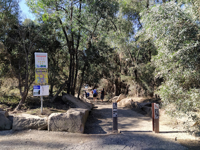
and made my way to Yarramundi Reserve, a waterside recreational area enjoyed by locals for its nature, off-leash dog area and swimming spot.


From here, you can join a wide nature trail with lots of others with kids and dogs.


Badly.


I head over the other side to Navua Reserve at Grose Wold, very nice spot but I am guessing it will have been heavily flood damaged as prior to this flood it had already been so. Been going there for over 20 years.
ReplyDelete